Squadron Movement MAPPING feature with Animations!
2025-11-13
UPDATE: All RCAF Squadrons ( that flew the Spitfire in combat ) have now been mapped. That would be 400, 401, 402, 403, 411, 412, 414, 416, 417, 421, 430, 441, 442, 443.
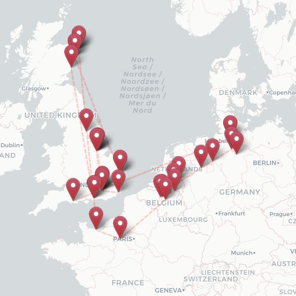
For any squadrons for which we collect this squadron movement data and create a map, the squadron page now starts with a large map showing where the squadron moved over time, and below it, all the pilots we have on the site for that squadron, roughly sorted by date. The map allows you to click through to see aerial views of these airfields as they are today!
Kevin Charles, our chief editor has had a crack at the RAF squadrons, in particular because his father served in 601. Kurt, meanwhile, wrote the mapping software along with features to allow (somewhat) easier imports of location, dates, and, squadron information -- as this data can get out of hand quickly. He is also doing the RCAF squadrons. It's still evolving, but we wanted to get a BETA release out to users so that they can have a look, and, provide feedback. What else would you like to see on a squadron page, we work on what users want to see, so don't hesitate.
If you let us know your favourite squadron and your connection to it, we'll get that on our "to do" list. You will then be enrolled in one of our special draws coming up (and that's a surprise) if you do!
What's quite fascinating about it, is that when you visit one of these squadron pages and you either animate squadron movements (click "start" on the map) then stop, or just click one of the pins, you get a pop-up with a link to the aerial view of what the site looks like today (google satellite view). I've already spent countless hours zooming in to see if I can find remnants of old abandoned airfields in the UK, Italy, etc. In many cases, the location is now an airport in use, in others, lost to the sands of time in the case of North Africa. Italy, also, had so many ALGs (Advanced Landing Grounds) whose very temporary construction would mostly return to agricultural use post-war or get swallowed up by development.
Keep in mind that while we are able to find lat/lons for most fields, in some few cases, we cannot definitively provide a lat / lon. So in a few cases, you may see the nearby town or approximate location, but we're working on that too. We will (soon) mark locations where we may not have high confidence in the lat / lon. And that's where you can join in the task and stare at satellite imagery yourself, comparing today's view with old WWII maps you find online.
Coupled with the fact that one location may have expanded to accomodate more units at a given time, such as in Lentini East and Lentini West or the many surrounding fields of Foggia Italy - there will be mysteries for sure. We welcome your corrections and input, just use the contact us at the bottom of the page and we hope you like this new feature. There is more to come, it's BETA release.
We will announce a new batch of squadron movement pages every few weeks, so have a look here until we create specific navigation tabs for our maps. Eventually, any squadron (unit) number on a pilot page will link to the associated squadron page with a map like the ones above, but at over 600 squadrons, this is going to take some time -- and so volunteers are welcome to help us out. Thinking about signing up to take on a squadron for our site and be the prime for it, let us know.
Kurt
post comment